How Field Experience Can Drive Product INNOVATION and GROWTH!!!
Dave Erickson 0:00
Your fantasy is to build a million dollar product, but how do you come up with a product idea that is really needed to create a successful business? How do you make your fantasy a business reality? On this ScreamingBox podcast, we are going to dig for gold by discussing how field experience can become technology product innovation. Please like our podcast and subscribe to our channel to get notified when the next podcast is released.
Dave Erickson 0:48
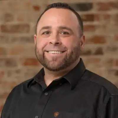
Coming up with a million dollar product idea is easier than coming up with a million dollar product idea that is based on solving a real world problem that will allow the idea to actually succeed. Welcome to the ScreamingBox Technology and Business Rundown podcast. In this podcast, I, Dave Erickson, and my co-host, Botond Seres, are going to examine how field experience can become technology product innovation with John Downing, co-founder and chief product architect of Litelligence. John is the co-founder of Litelligence and the founder of Littell, and he began his career in heavy civil construction, operating equipment, and later working as a civil estimator, manually calculating dirt quantities. That firsthand experience led him to invest early in high-end drone technology, long before it was common, and to grow Littell into a nationwide Lara service, helping contractors uncover change orders and optimizing dirt movement today. As Chief Product Architect, he is leading the development of new AI-enabled software built from the ground up for field users and already deployed by national developers and major contractors. John brings a rare blend of practical field insight, technical vision, and a deep commitment to empowering the people doing the work on the ground. John, welcome to the podcast.
John Downing 2:05
Thank you. I'm glad to be here. Can y'all hear me good?
Dave Erickson 2:09
Yep.
John Downing 2:10
Okay.
Botond Seres 2:11
Yes.
Dave Erickson 2:12
So, to start with, why do you like digging in the dirt, and how did that lead you into technology?
John Downing 2:19
So, yeah, we'll start back from when I got out of high school. Dirt wasn't my first option, but when you don't plan on going to college and you don't have any other plans, and you've got friends that move dirt, you kind of decide that's what you need to do, because it paid the most money at the time. What I didn't realize is I was going to be digging silt out of a manhole on my first day, so that was a horrible way to start, but I don't know. As soon as I got on me, you know, started getting on more heavy equipment, it just.. I don't know, man, something clicked, and I just became really passionate about it. I don't know if it was being able to create something that's on paper in reality, you know, and getting to see it move from nothing to something, but it just stuck with me, and I just.. I love, I love that environment, I love the people and the camaraderie, so I just stayed in it.
Dave Erickson 3:24
Well, it's not every day that people who are passionate about something get to kind of create a product. What got you started? When did you first start thinking, hey, there's got to be a better way to do this?
John Downing 3:37
You know, there was.. I had moved, I had moved up along the ranks, and GPS had came out at that time. I'm fast forwarding a pretty significant time lapse here, but I would manually have to walk the job site with a handheld rover and take shots, and these, these projects were 30 to 50 acres large, so you know, fat me in the heat of Georgia, you know, 100 degree weather, humidity at 125 it took, it takes a long time, and plus, you know, I'm not capturing everything the entire time, either. I'm missing large chunks of area, just trying to get it done in a day, or two days, or three days. Meanwhile, they're moving, you know, 10 to 30,000 yards a day, so I'm hitting, I'm trying to quantify a moving target, if that makes sense, so by the time I'm done, I get back, you know, upload all that data, analyze it, you know, and we got to where we could get it, get it close, you know. We knew it wasn't 100% but it was close enough to kind of get an idea of where we were. Well, back in 2016 the I saw where a drone was coming out, and I actually still have that drone sitting over here in my office. It was RTK capable, meaning I could use a VRS stream to connect it to for corrections, or I could tie it into our base station, so you know, I had the dude come out, give us a demo, and it did what I did in 15 minutes, and so I went to the owner and said, "Hey, I mean, I think this is something we definitely need to invest in, and it was $65,000 in 2016 but luckily he'd been accustomed to buying $650,000 bulldozers, so it made it a lot more simple to to pull the trigger on that. Now, when I went to the training class to, for post processing, the very first initial training class with this drone, I was the only one in the room with a $65,000 drone. Everybody else had something they got for Christmas, and it was such an early adoption. No one, we were just on totally different levels, so you know, went back, said, "Hey, we're way ahead of everybody. Let's start a business. And he was like, "Let's do it, so Littell was born.
Dave Erickson 6:49
Over the years, we've seen many different product ideas. Some of them are based on, "Hey, there's a real problem, let's solve it, and some of them are just based on, "Hey, I want to make a product, and I think this is a good idea, but the ones that actually succeed are the ones that have a real world application, and you know.
Dave Erickson 7:10
That's what's interesting about the process that you went through, and that's what I think people want to learn from, is how did you take this kind of idea, and why did you come up with the idea, and then how did you make it a reality?
John Downing 7:23
Yeah, once I came up with the idea, well, you know, that was the idea of, of how do we do this faster. That solution came out, and it provided the imagery with it as well, and then the very first job that we did with this drone, we'd already purchased it. I'd already learned the post processing. I knew how to do all this stuff. We found a 30,000 yard topographical bust. We would have had no other way of knowing that there was a bust, because what it came down to was,
Dave Erickson 8:05
we, what is a bust?
John Downing 8:07
A bust is where you're given a set of plans and a CAD file to estimate the job. Now you don't know any different, all you know is they've given you this design and it's overlaid with this existing and honestly there's never really been another way to check it and so we went out there and found that when we using the CAD file but changing the existing surface based off the surface we just collected from the drone imagery in the drone, you know, the topography that the drone provided, and we were actually tied to a virtual reference station, so we weren't using a local base station, meaning we weren't using what the surveyors provided us now this the only way to do a double check, which we had no idea about. We didn't know we were going to do that. We were, we just, because they call 00 on the paper in real life, that can actually be raised, or it can be adjusted. That elevation isn't always that exact elevation, so what had happened is the whole site was lowered one foot. Now that whole time I was checking manual with the rover, it was because I was using survey control, I was shooting the shots, and I never noticed a discrepancy because I was using what I was provided. Well, it all made sense, you know, like you have no reason to question it. Well, once we, once we used something different, and then ran it, we found out that the surveys were wrong, and so you never, I mean, that's that's such a light bulb moment when you, when you catch something, and at the time I think dirt was going for about $4 a cubic yard, that's what majority of the estimators in Georgia were charging, so you take 30,000 yards of dirt and times that by four, that's that's the amount of money, that's the difference right there, and what had happened is we had, we had already graded majority of this site, so we're down to the last quarter of the site, the owner had came out there and was like, man, something just feels off, something just feels off, which is something we say all the time in the field, something just feels off, and, but we can't prove it. We have no way to prove it, other than GPS, which was new at that time as well. So, not ,not being able to check it, and then this reality of, well, this job's wrong, you know, it's always the dirt guy's fault, so you know no one else, unless you can prove a surveyor wrong, they're not gonna, they're not gonna admit it. And on this site, in particular, this very first site we flew, we were able to get a change order, and they had to redesign the remaining portion of the site, and that was just like, man, I got to take this to the net, that you know, take this to the world, and so, but that was also the hard part, is once I got out there, and you know, I had to do my full-time job as well, estimate in GPS machine control stuff, but going job to job, trying to get others to believe in, look, I can help you find a potential change order if you just let me fly my drone, which you're talking, you're talking to a bunch of people from Georgia that that barely trust GPS, you know, it's a very skeptical crowd to start with. So it took, like I said before, is it took two years before I even got to where I could get someone to adopt it, and at that point you know it's, it's hard to keep believing in what you believe in, but you know I had been the guy in the field that something didn't feel right for a long time, and you know you don't know how to, you don't know how to explain how something feels, you know what I mean, to people that don't understand, you just know something's off, you just have no way of proving it. There's, you know, it makes it very difficult and frustrating when you're the guy in the field, especially when you're in the superintendent position, and you got the owner looking at you, and you know he don't visit the site, but you know once a year you've got, you know, everybody else looking at you like, yeah, ol’ country man that runs tractors out here, you know, what does he know? Because that's that, honestly, that's how people looked at us, is you know, we didn't, we don't have college degrees, we don't have, you know, CAD, you know, all these advanced programs, because we moved dirt, you know, but
Dave Erickson 13:39
same time you're using, actually, even in the beginning, using GPS, those are sophisticated technologies, and then putting in the data and doing the data analytics, so even though you didn't have college degrees, you understood the technology, and you were able to apply it.
John Downing 13:57
Yes, and I was blessed enough to be able to to get office experience about halfway through my career, which was, you know, from, from literally in the field, was about 12, 14 years later, once I got in the office, it all made it started making sense, and so, yeah, I started to be able to take my field experience, plus the experience I was gaining in the office, it, but my heart was always in the field, so everything I would find out, I tried to work harder in the office to help the guys out there that felt it, but couldn't prove it, but there's so many different variables that are at play, besides, you know, I don't want to get off on a tangent on surveyors, but you know it was there, was never a way to prove them wrong, and I was illegitimate because I didn't have a stste stamp license, which you know, continues to be pretty much what motivates why I do what I do now, is because everybody looks down on people because of this, that, or the other, and I want to change that narrative, because the most salts of the earth people I've met are people that work outside, so you know I'm able to take all these things I've learned every every time I learn something new, put it that way, every time I am taught something a better way, my immediate go-to is I can't wait to take this. I can't wait to push it. I can't wait to show these guys in the field, you know what I mean, because you know I want to help them understand, and you know that it's, you know, I forgot the original question, but that was, you know, that's my motivation. Is like every time I learn something, I want to, I want to run back to where I came from and show them what I've learned and how it applies.
Botond Seres 16:13
If you don't mind, I would love to hear more about the specifics of this one drone, like you said that it uses GPS and cameras. Yeah, at that time, did it also have Lidar, or is it
John Downing 16:27
Lidar? Wasn't even at that time. Lidar wasn't even. They may have had it, but it was so expensive. No one had it. No one I knew had it at that time. We bought this drone, it was a sense fly. It's a fixed wing drone. Have it sitting over that, can't even remember, is EB Plus, EB Plus.
Botond Seres 16:51
So it's not the typical four authors.
John Downing 16:53
No, so when I went to the trade show, it's
Botond Seres 16:56
massive, right?
John Downing 16:57
Yeah, I had something. Yeah, everybody, I wish I can. I can bring an example over here, but I had something, you know. Lord help, I wish I could.
Dave Erickson 17:08
handheld drone is probably a small handheld drone. Thinking, yeah,
John Downing 17:12
A small yeah. In this drone is literally, it's it's got a five foot wide wings. It looks like a crow, or not a crow, but a buzzard once it's up there at 400 feet, it looks like a buzzard flying. So, yeah, when I'm in the classroom with these guys, learning how to process this, I'm, I am literally looking around, and they have something that is handheld, and I'm, I have something you have to like launch, you know,
Botond Seres 17:44
How do you process the GPS and the images to have a cohesive hole?
John Downing 17:53
So, yes, at that time I had bought it, I had bought that drone, that specific drone from a from a reseller, and I had got a perpetual license to a processing software called Pix 4d and so that's the training class I went to was Pix 4d and so what we would do is we would, we would go out there initially, collect the data, tie it to a virtual reference station, which is basically just a signal that's not tied to that site. Is that makes a
Botond Seres 18:33
radio beacon?
John Downing 18:35
Yeah, basically we're, we're, we're connecting to somebody a subscription where they have multiple base stations set up that triangulate. Yes, so, so there's two ways of doing it. There's, there's site control, which is localized, which is within the limits of your disturbed area, we'll call it. Does that make sense? In the limits of your your sandbox, and so the surveyors provide those points, you take your rover, you set up a base, and then you shoot their points and use their elevations, and you say, okay, this is what it is, now you're free to walk anywhere inside that circle or box and get accurate elevation, well, a virtual network is where hundreds of stations are being used virtually, and they're all triangulating together, and so no matter where you go, you can just turn it on, and it's accurate within 1/10 Accuracy is what most people kind of, kind of hold true to. That's just your typical GPS accuracy. I mean, it's a float, it floats, you know, and there's a lot of things that can affect it, you know, mask angle and things like that. But,
Botond Seres 19:51
Right, but you don't need to bring your own beacons, it's already set up and it's everywhere, basically.
John Downing 19:57
Yeah, it's already everywhere, it's just how much. You want to spend, and you know, if you're nationwide, you know, we bought a virtual network, it's End trip, End Trip network, which served our local area at the time, and so the drone was, you're able to connect the drone directly to it before you even take off, so we would, we would connect to the End Trip network, throw the drone in the air, let it do its, you know, flight mission, come back, it would land, and you know, the fixed wing drone was difficult because it landed on its belly every time, because it, that's, you know, it was no coming down easy like this, you know what I mean. So you're looking at like this runway, trying to gage where it's going to land, hoping it lands exactly where you told it to, but that was never the case. It would, it would catch a little burst of wind at the last minute, and Lord help, it would land about 50 foot from where it was supposed to, you try to, it was like playing catch in the outfield. So, anyways, that was it, was fun days learning the fixed wing drone, but I'd go back in the office, process it well, you know, and a lot of times initially is after testing it. I had to fly five to 10 jobs, you know, a week, so which means I would need to do three or three jobs a day. So I would sit on site, process the data in my truck on my computer, and that's basically I load the imagery, I load the geo information that you know, bring it all together, and then create this image, one universal ortho orthomosaic image that's that's geo referenced, and then I would tie down to a geoid system, which is a geodetic way of bringing things into your, you know, coordinates that you want, however you want to display them, and we use specific for that here, but most people use a state plane coordinate system, so to bring it to that, bring it down to that coordinate system, which I had to learn an extreme amount of math to do that. I didn't know what, we don't do things in meters here. Well, in America, for the most part, in measurements we, we use US survey fee, and I was the, you know, on a world level, we're so much different, man, and it's hard. You got a times
Botond Seres 22:48
painful,
John Downing 22:49
I know, but everything has to be converted by 3.28084 like that number pops out at me because I know the exact math. So, yeah, even when we would run it through this system, we had to take it times it by 3.28084 that would give us our offset to bring it down into state plane, and we would then I would run it through another program called Ag Tech, whereas that's where we pulled in our design from CAD and our existing from CAD. Now we're pulling in our layer from the top, the topo we just ran. Now I'm bringing in the orthomosaic image, I'm bringing in the the grid of the points I collected in, and that's dependent on your computer's resources as well, so now at this point I've got this $10,000 gaming computer, laptop gaming laptop, you know that I had to get built in Canada because it was just massive that we've got them stacked up over there just as collecting dust at this point, but you know, your graphics card, your CPU, you learn all these things as you go, your RAM, you're just, you keep your storage, like you just keep building these monsters to keep getting better. So, yeah, anyways, having a built-out computer, built-out programs using five different programs that cost 10 to $25,000 a piece, you know. Finally, we can tell what the answer is, and that is just click this button. But you have to have knowledge of every single one of those programs, and so you know I had to show people how to do that in house. So hopefully I circle back around to your question, but
Botond Seres 24:45
you answered that a long time ago. Yeah, okay, we need to ask, since then did you get into Lidar and like these newer VSTL drones?
John Downing 24:58
Yeah, so we. Yes, Lidar came out shortly after I started getting people to adopt photogrammetry, so just when I had it mastered and just when I was able to turn a profit, they started asking for Lidar, and I was like, 'Dang, what's that? I knew what it was, but I was like, 'Man, you don't need that, you know, but it was the, it was the latest and greatest thing, and so here I am shopping for Lidar, and so just as we began to perfect that process, now we're starting Lidar, so started shopping lidar, seeing how much it cost, it was expensive,
Botond Seres 25:42
and then you need a more expensive GPU as well I suppose.
John Downing 25:47
Well, you need a whole different drone. You can't use this at that time. DJI is the world's largest commercial. They're just the world's largest manufacturer of drones. I mean, I mean, from microphones to drones, they do everything, and it is, it's awesome, but yeah, so I thought I just bought the $65,000 drone with the payload, but now I have to buy another one, so some people are still asking for photogrammetry, but now I have to buy this new drone that's RTK that is made by DJI, which at that time wasn't a big deal. We can fast forward 20 years later to where it is a big deal if it's coming from China, but you know, so we ended up getting a, a M600, which is, we show it still because it is, it is like a six foot radius, it's it's this monstrosity of a drone, and if you're doing a demonstration for somebody, that's the one you want to pull out, because it's just this wow factor of oh my god, that thing is huge, and then sync it with a $250,000 Lidar sensor that goes underneath, because that's what the first one cost, and so, yeah, but early on there was no obstacle avoidance, there was no cameras, there was no once it went over the trees, you didn't see it, so that's where our relationship with God came into play, because you were, you were praying at that point, like you had, I mean, unless you had 10 people with binoculars, you didn't have visual, so you said it to this, this, you know, this is early on, man, so there was no terrain knowledge,
Dave Erickson 27:41
yeah,
John Downing 27:42
you know what I mean. It didn't know. I think there was a.. there was one run program out there called Lee Chay, which a lot of drone guys were doing when, if they were flying cellular towers, you know, that's something I didn't want. I wanted to stick to dirt. I mean, obviously I wanted to try to make money doing everything, but, but LeachA, if you use it with a lidar system, you select your way points on the screen, so you do all this, but they're tied to an elevation. Now, if you accidentally didn't change the elevation at that point it's going to the ground, because it, yeah, you don't know how many people I know that did that, because this is before terrain following, so you were guessing at elevation heights. Well, people that were asking me to fly weren't asking me to fly open, over open area, it's, it's 100 foot tall pine trees, you know what I mean. So, no one can see over that, and you can only have one pilot, so there's, there's me flying that, but sometimes we'd have another pilot over here flying another drone just to keep an eye on it, but Lord, it was that was I don't know how we never crashed, to be honest with you. We, I never said no, and anybody that asked for it, we were so heavily invested at that point, but the accuracy was unbelievable in being able to capture one to three, what did well, we'll say three centimeter, just for those who like meters three centimeter accuracy, vegetation,
Dave Erickson 29:35
So you pretty much see every rock in the ground,
John Downing 29:37
dude, vegetated, now we're now in these were developers that were asking us for this stuff. Why are they asking for it as well, Before we spend $16 million to buy this property, we have seven days of due diligence, or 30 days, or whatever, but we've got in that time, we've got to do a Topo. To engineer it and run a budget, see how many lots we can fit, figure out this makes sense. Well, luckily they don't mind spending money in due diligence, so you know it. That carried us into the lidar revolution, and at first it didn't include photogrammetry, it was strictly Lidar, which is just measuring return. Our first, our first one measured probably, oh, max 200 returns per second, or I'm sorry, 200,000 returns per second, you know. Fast forward to the one we have now, it measures 600 and we'll just call it 700,000 returns per second, that's per second, which is crazy, and it's got obstacle avoidance, it's got terrain following, it's got cameras, it can, it'll tell you, like, hey, there's something up here, watch out, you know what I mean, and so it'll stop itself, but you know, in the one thing, good thing is, is, is we used to have to worry about hawks, the birds.
Botond Seres 31:22
oh,
John Downing 31:22
Birds of prey in Georgia are our birds of prey, man. They do, they
Botond Seres 31:27
consider drones, dude,
John Downing 31:30
the fixed, the fixed wing drone, and it would literally.. we've had, you know, the only good thing about it, which I could keep me on track, because I'll go, I'll go way off subject real quick. So, and this can turn into a four hour conversation, so that drone, you know, we didn't have transponders back then, so you know, no one knew where it was, but we just watch it, but we didn't know where hawks were hiding well till the day we found out this thing comes in. I mean, it's wings back like it's, it's going to kill it, and we see it in real time, you know what I mean. And it doesn't just, it doesn't just knock it off course with its head or beak, or whatever you want to call it. It grabs it. Okay, now, now we're down there at the, at the truck on the computer, and it's, it's given warning, warning, warning. It not only takes it, but it grabs it like it's another bird by the wings. This is the fixed wing in, in at the speed of sound, takes it to the ground and just smashes it, destroys it into nothing, and so at that point we were like, okay, we've got to start being very careful of birds of prey, falcons, hawks, especially in Georgia, are a big deal, I mean, the Atlanta Hawks, the Atlanta Falcons, there's a reason they're named that these birds don't, they don't play, so yeah, we saw one get demolished, but luckily the ones now have these massive blades on them, which you know will chop a bird up if it gets too close, you know what I mean. I mean, these are fixed wing drone, only had one propeller on the back, that was it. We went from that to eight propellers, well, eight times two, there's eight. Anyways, you know,
Dave Erickson 33:35
It's a good story about nature meeting technology.
John Downing 33:38
It doesn't like it, It did not like it, but now you know. I don't know what it is, but they're there, they're, they're cool with us. We've made a pack somewhere in the sky. Look, we'll only be up here for 10 minutes, man. We won't, we won't bother you. You don't. It's kind of the same, same, same pack they made with cars back in the day. It's like they know when they get it, they know when to sway away. Yeah, you know. And then there's that one bird, it's like, man, you, there's an old sign failed, and this might be something y'all ain't seen before, but there was an agreement we have with birds and cars, like they know, hey, we stay out of your way, you stay out of ours. Well, that's, that's where drones became, but you know, we, we still have it, we still watch out. You can tell when you go into a forest, you know, when someone's wanting us to do 10,000 acres, and this is this is vegetated, this is hasn't been disturbed, this is for forestry, or somebody, you know.
Dave Erickson 34:40
That, but that, that also brings you the fact that you're processing a lot of data.
John Downing 34:45
Yep,
Dave Erickson 34:46
And you're indicating you used a bunch of software tools. Eventually, you kind of.. and that's the basis of intelligence, is you decided to kind of start looking at your own software tools. Maybe you can talk a little. Little bit about what kind of brought you to that point, or why were you frustrated with the other software tools, or just wasn't doing what you needed, or what was your kind of thought on why you needed a software product.
John Downing 35:12
The order of operation would be people would pay us, or people would call us, say, "Hey, can you come fly our site? We would say yes, then we would fly it, and we always push ourselves to have 24 to 48 hour deliverables, because that's that's dirt me trying to make decisions, like I know this guy in the dirt is going to need to know, you know, tomorrow or the next day, day after that, what to do to balance his site, so we would get the proposal, sign contract, go fly it, send them the deliverables, and it takes a long time to process Lidar deliverables, all right. Well,
Dave Erickson 36:01
And that's processing, right?
John Downing 36:03
Yes, the deliverables, the just processing a raw point cloud is, we'll say, five gigabytes, that's just being generous than average, and for five gigabytes of data is a lot. I don't know if y'all know that,but you know, we take that file.
Botond Seres 36:24
Depends, do you need to hold it in RAM, or well, fine to be paged fit?
John Downing 36:29
So this is on one person's device, so A, we, we had to upload it from the field to our one of our guys to process it. The upload took forever, and then the processing part, and then there's the deliverable part, which is something they can use. Well, we would send them a link, so there's three different types of people that would use it. There's there's the the grading contractor out there, there's the developer. The developer would be like, dude, that's cool. What, what does that mean? Like, I can't open this, you know what I mean? Like, I've got a Dell, you know, have a cheap Dell, like, or that the office gave us. Like, what do you want me to do? Like, that's awesome. What do we do? And then, or we'd send it to an engineer, they would try to open it, and they're like, this is too big, CAD can't handle it. And it's like, all right, so now we're coming back, and we're trying to dumb it down. Well, what do you need it to be spaced at? Surveyors are using Carlson or something, AutoCAD, the same, they're all using the same programs. How do we dumb it down enough and still keep it accurate? So I was getting frustrated because, a, they were just like they wanted an easy button, which we, you know, there ain't no such thing as an easy button at that time, AutoCAD still uses a very outdated way of, you know, they're the standard for a reason in design, and that's they don't give it, they don't care, they don't care, you have to adapt to them, and you know, so it's just so people, so many people use it. You have to, but when it comes to geographic information, you start getting into what's called cartographic territory. Engineers draw in smooth, pretty lines, you know what I mean. There's not a lot of what's called vertices in that line, there's a point here and a point here, and it only has two elevations, but the whole line represents that elevation, or it's called out as a text box on a piece of paper, very low data. We would, we'd spend a lot more, we'd spend a lot of time dumbing it down for them, so we would spend, you know, hours simplifying it, sending it, them trying it, sending it back. That just impedes the process, so you know it's a week later now before they've got that answer for their customer, or whatever. Then you have the dirt guy, the contractor, who's the bottleneck is it's back to the estimator, it's his job to take everything and then find the balance. Well, his main job as an estimator at a heavy civil construction company, their main focus is to get work, not to go backwards, it's to get work well. They're using one software, and that's AgTech. AgTech is the gospel when it comes to dirt guys. If you didn't, if you didn't calculate your earthwork in Ag Tech, then you can't trust it. Period. That's just it was taught to me that way, and that's. They've been around for a long time, it's a great software. You have to know it, though. You have to be really good at it to be, to be accurate. But still, you're still tied to your computer's resources. Say we're taking, we're shoving all this information into somebody who already is bottlenecked with future work. Now they're focusing on past work, so the last thing they want to do is go backwards. So now they're waiting. It's a week later, they're now looking at the file and they're calculating something, and then it's a week later before it gets into the field, before they've ran their volume report. At the end of the day, the only person I know that suffers is the dirt guy. It's you can't wait one week, two weeks, three weeks, one month to make a decision on a topo you did when you have an active, you know, target moving, you know these big guys can move a lot of dirt quick, especially if they're getting paid to do it that way. You know, that would've been my motto of my business, is you know, time is money, and it is that the longer it takes us to get you a deliverable, which is a Lidar file, a usable file format, the longer it's going to take you to make money, so that's why they love us, because we, you know, I push my guys to, for that same, you know, turn it around quick.
Botond Seres 41:34
So, in the end, how do you dumb such a file down so that it doesn't lose too much resolution.
John Downing 41:41
Okay, you keep spacing it out. So we went from centimeter spacing, because that's what we received, that's what the Lidar did. It gave us it. It collected the Mayan ruins and 400 tires that were thrown in the woods, you know. In the meantime, we can see all that, you know, but we edit it out, we take it to ground, we reduce it to where it's just a ground surface, but you're still dealing with a very large data set. So once we'd send that file over, they, they're, they would, they would call and say, "Hey, I uploaded this thing into Civil3D and it's been spinning for six hours. Is there, what can you do? All right, well, to rate to retain accuracy, we would start with just spacing it five foot, so we would space the points five foot.
Botond Seres 42:43
Oh, that's quite a distance.
John Downing 42:45
It is quite a distance. So, what that does is a word, it's called interpolation. So, now if we take point here, point here, we had everything in the middle. If you pour a glass of water out on the ground in the dirt, it's going to, it's going to jig and jag and snake around every rock, nook and cranny, because that's the way the earth is, and that's the way the, lLidar collected it, and that's what it looks like in real life. It's not smooth at all. Well, they can't. We would send the five foot grid over, hoping that would be good enough, you know, without losing too much accuracy, because we're telling them, hey, you know, you paid for accuracy. Where do you want it? Where do you want that to stop? You know what I mean. And so they're like, well, this is for this, just send us a 25 foot space grid, and now I'm like, oh, you know, yeah, we'll generate our own two foot contour intervals off of the 25 foot grid, because we want it smooth. Well, that's,that's not accurate, but they, you know, what they have a stamp and they have a license.
Botond Seres 44:04
You don't need accuracy, just needs guesstimation.
John Downing 44:08
Yeah, but why you paying for accuracy if you're just gonna guesstimate, right? You know what I mean. So, dirt guys, dirt guys are actually moving, act like real.
Botond Seres 44:21
I'd be paying for the option to be more accurate in the future, but for the moment you just need the rough outline.
Dave Erickson 44:30
And part of that, their own limit, right, that I've seen this a little bit also in some of the AI work we do, particularly in healthcare, where they say we want an AI to do this and we say great, we can do that. What kind of infrastructure do you have? Oh, we're running it on a web server. Well, you're not going to be able to, I mean, you're not going to be able to process the AI fast enough, because you don't have enough power. It's kind of like what your customers are going through, they want to run it off of a laptop they bought at Costco, not. Yeah, yeah, not, not at five inches, right?
John Downing 45:02
No, yeah, no,
Dave Erickson 45:05
you need to kind of have enough to
John Downing 45:06
optimize it, yeah, you have to, yeah,
Dave Erickson 45:08
oh, you want to process this kind of data, we'll go find a real computer.
John Downing 45:12
You know what I mean, and that cost, yeah, you know, and it's, it's very, , it's gotten to where it's, it was so stressful because they would want this, they needed the topography to be act to run accurate calculations to design accurately. Now they're once they've dumbed it down so much, or it's gotten cartographic, and it's just a smooth, pretty picture. There's nothing real behind it. That hill isn't a hill, it's actually a gully. You know what I mean? That you know, it was a high, there was a high and a low, and another high and low in between 25 foot of space, like you know. That just dumbfounded me, and it frustrated me, because you know we've got all this data, and in here you want me to, they would also pay us to calculate it. Well, I'm going to calculate it using raw data. I want to know, I want to calculate all every speck of dirt counts, and so that segued into what they wanted next, and that's well, we're going to pay you to do it, and then, oh, we also want you to tell us the exact thing that we want you to balance our site for us.
Dave Erickson 46:40
What does balancing the site mean?
John Downing 46:43
Balancing a site means within the constraints of the project, the limits of disturbance. We'll call it this is, the, you know, the square that is going to be cleared and moved. We want to make sure that within that square, circle, whatever, polygon within this limit, that whatever we cut, we fill the exact same amount, that way there's no need to export dirt from the site or bring dirt into the site, because you go from an industry standard of, we'll call it $2 a cubic yard to move dirt, all right, that's on site. It's $25 a cubic yard to get rid of it, or to bring it in. So you can, you know, that's, that's a massive dirt difference. Most, most sites have 40 ton off road trucks, and they can move, you know, 30 cubic yards in one trip on site, which is, you know, 1500 feet away. That's where the cut was. Then the fill was 1500 foot away, and that's where they dump it. And then they're, they're doing that all day long. It would take a dump truck, a tandem dump truck that goes on the, on the road. They're only allowed 18 tons. Well, 18 tons equates 10 cubic yards. Well, that's significantly less. And, and they get stuck in traffic, they're going to go, want to, they're going to stop to use the bathroom, they're going to eat. So now you got two hour turnarounds instead of,
Dave Erickson 48:25
and now with fuel costs, it's going to get even more expensive
John Downing 48:28
even more expensive. So, yeah, the goal is we do not want to waste money bringing dirt in or taking dirt out. What we'd rather do is balance the site within itself, meaning we'll take the amount of, we're taking this design that the engineer came up with, and we need to make it work, so that means all right, this is what he said we needed to do, but to do that, we need to raise the entire site three tenths, three tenths of a foot. We do everything in tents and dirt, so raise the entire site three tenths that, if that, that accumulates that volume of net, whether it's good or bad, but the job didn't have enough dirt or it had enough dirt, so you either raise or lower the site accordingly. That's, that's where this all comes into play from the get-go. If a developer does it before he designs it, before it's cleared, he now knows within, you know, a 10th or so, the engineer can design it that way, but it depends how much they want to spend up front. If they don't want to spend the money up front, what they're going to do is they're going to, they're going to just use a GIS tile they can download for free, or pay $100 for a square and have outdated, we don't know where it came from, but to be honest with you, there's no guarantees of where it came from, but an engineer just got paid $100,000 to design an entire job, an entire subdivision off this. Well, guess who's going to get paid to do it again when it's wrong six months later, and it's, and it's going to cost, you know, the budget is already $3 million more at this point, and so all these things equal dollars at the end of the day, and so the relevancy of geospatial data in collecting it, processing it, and using it, the bottleneck is always the same. It's the guy who interprets it. That guy alone is, is who can either be Johnny on the spot, and, and run those calculations, or you know, he can be like everybody else and is overworked, and it might take a minute, but by the time it gets to people that need it, it's too late. And so, for my end, being the guy in the field and working with so many people nationwide in the field, it's the same frustration nationwide is we just want to know what we need to do, and so between the combination of people calling me, asking me for Lidar or for an earthwork volume calculation, show us where we need to cut, show us new where we need to fill, and then what do we need to make it balance within what we have, what we're under contract. This, this amount of acreage, what do we need to do to fix it? You know, and I'm giving that information away for free, just because they paid for the data. And then I feel bad, to be honest with you. It hurts my heart to see a guy I know that has his, you know, it's everything's tied to his family, you know, his business, and he's running a multi million dollar business, that is his, you know, him and 50 other guys are dependent on, man, like you already fighting Mother Nature, you're already fighting, you know, there's so many elements outside you fight that you don't fight inside. It's always sunny in the office, but in real life, you know that means you know it's harder to make $1 and so I wanted, I wanted to create something that blended everything together, where you know, and yeah, tying this all back together, I guess, is is Litelligence was an idea that just so happened when we were rebranding Littell, our marketing company came in, me and the owner were sitting down talking with the marketing company about taking our old Littell logo and, you know, making it look fresh, you know, updating our website and stuff, you know, you know what they do, you know, $100,000 later, you know, but we were.. I was trying to define.. we were downstairs in our conference room, and we were trying to define what we did at Littell, and we have a massive white board down there, and unfortunately that dude was. He got the Sharpie, and he was like, so tell me what you do, and I have a picture of it, and by the time I was done explaining everything, the whiteboard was full, like, there was, I mean, he, he, there was no room left, because you know, there was so many different things we do that doesn't fit in a box, you know what I mean, and he was like, dude, we need to develop a software, and at that point I wasn't the last thing I was thinking about is developing a software that I had to do, and when I say I, I meant like my brain had to work with someone, but he knew a guy who was a very high paid, well established enterprise level engineer, and it was his, that guy's best friend, so he told him about it, and the dude was like, "Dude, this is revolutionary, like I'm gonna quit my job, we're gonna, I'm gonna focus 100% of my life to doing this, and I was like, "I guess I am to. Do you know, so he, within a year, you know, he was able to pull out of my brain everything I wanted to pull out, speed, accuracy, speed, accuracy had to be the number one thing, at the at the top of the list, so we went through so many revisions, and he would lay it out so beautifully, and and it was so nice, but it wasn't fast enough. Or let me run that through what I trust, and that, that you know, the dirt numbers, it's close, man, but it, you know, something's off, you know, you need to, it's, it's not calculate, it's off 1000 yards, it's not good enough, and you know him and the team he put together, they're all like, dude, we don't know what the hell this guy's talking about, like I don't know how many more decimals we can go before it calculates, it's not right, it's not right yet, it's not right, but within a year, within a year,
Botond Seres 56:04
Accuracy is extremely underrated in the software industry, what's that? To be honest with you, accuracy, accuracy is extremely underrated in the software industry in general.
John Downing 56:14
This is, yeah, I agree, I agree, but you know, I tested it and it's proven, and I tested it, tested it, and tested it, and I didn't come up with my own workarounds in these high-end softwares to make it more accurate, where you know,
Dave Erickson 56:30
I mean, that's where the field experience really came in is because you were able to look at it and you just knew it was off, and you know, the problem with a lot of products nowadays is that they're designed by engineers without any field experience, and when it gets out in the field it ain't right.
John Downing 56:48
In 100% so I realized there's, there was a couple companies out there that had a platform in this, these were platforms, and I say that, like that, because they were built for photogrammetry, built for photogrammetry data, and they also had venture capital money. They were, they were coming in with investor money, and investors will throw money at you, and so they were able to give it at a high level, they came in high executive level, promising this, promising that, it looked good, cool. Let's go to the club now, or where? Let's go to Bermuda, or whatever. You know what I mean? I mean, they're, you know, how salesmen are when they've got a bunch of money and executives, and by the time I got down to the field, I literally had people that their companies had signed exclusive deals with these platforms, but they're like, "Dude, I don't give a.. I don't care, I don't want to, I don't want to cuss on the show, but you know, I don't care what their, what they told us to use, we don't know how to use it. It's not, it doesn't make sense. It sucks. It's, it's just got too many variables that are uncontrollable, and we just need you to come out here and do it for us. So we were still getting paid, and it would frustrate me, because at that time we didn't have a platform, so you know what I realize is at that time is a, we've developed a platform for Lidar, raw lidar, we didn't develop a platform for photogrammetry, now they're getting all this change order money because they're trying to catch up to provide their platform to host photogrammetry. Now they have, but they're also using so many outside variables. They developed a software, and that was it. They didn't have the pilots to service it, so they had to make a network of Tom, Dick, and Harry's across the country, who are getting paid $250 to go do this site with their own equipment, and they're, they need surveyors to go out there and set these massive Xs on the ground. Well, if you're moving dirt, these Xs can't stay in place the entire duration of the job, you know what I mean. So, well, that was that was a design flaw on their part, but they didn't care, they already had the contracts, so this, this Tom, Dick, or Harry would come on out, he all he knows is he's just supposed to fly his drone, his Mavic2, you know, you know what I mean, that's that's what he's, he got paid 250 bucks, and he's like, yes, he doesn't know anything about why the X's are there, he doesn't know anything, he's not, he doesn't know, he doesn't know, he's a hard hat, he just said, look, I'm just here to fly a drone, bro, you know, Mama got me this for Christmas, I'm 21 I just started my own business, I'm. Signed up with, you know,
Dave Erickson 1:00:01
Yeah,
John Downing 46:43
This company to do this, or whatever, you know, they're not carrying million dollar limits of liability. He don't even have insurance. He pulled up on a Honda Civic with no safety vest, you know, no hard hat, no work boots, but you know, he's out there now. He flies the job and it uploads directly to said platform that's available. Well, the guy up there in said platform analytic land is like, oh, this doesn't work because this tile moved or this x moved, so we can't tie the job down correctly. Well, we need to go back out. You need to send Bob back out there to reflight now. Whoever's in the pilot network back out there to go fly it. So he goes out there. They've, they've since then, they'd had a surveyor come in, set another point, shoot it, make sure it's exact. Northeast elevation is precise, it's got precision now. He comes back out and reflies it, and hopefully this works, and it's repeatable. And they've been lucky 75% of the time, I'd say, with it not being disturbed, but there's 25% where it cost, and I saw all the flaws in all these other platforms, and we, we developed ours from the bottom up, and we developed it to currently we developed Litelligence off of, you know, Pat, we call it Litelligence powered by Littell, because we are in control, we don't have a pilot network, everybody is salary, we pay, everybody has a vehicle, everybody has a computer, everybody has top of line equipment, everybody's in house, so if you mess up, you're gonna hear it, you know what I mean, I'm not just sending somebody, and everybody here is OSHA certified, like it's like, look, you're gonna go through, you're gonna understand why you're there, what type of people you're gonna deal with, you're gonna know you're not supposed to walk in front of an off-road truck, I don't care if it's got machine control, like, it don't know human, so you know what I mean, like, you got to teach them these common sense things in house, and so A, we have a platform that is able to handle this data at a very large, you know, very large data, it's able to handle large data. The one thing these other platforms were missing is the fact that it's limited to a desktop. No one was, nobody ain't nobody in the field uses, is using a computer in the dirt. I'm just gonna tell you, nobody's walking around with a gaming computer. Trust me, I've been out there. You might have a, you might have one site superintendent that has access to some sort of tough book, but it's truck mounted, and you know, and he don't even use it. This dude don't even want to get on a computer, you know what I mean, unless it's to download something or upload something or send somebody a picture. They're using iPads, iPhones, I mean, that's just fact of the matter. They're using,
Dave Erickson 1:03:23
not going to process enough data or anything.
John Downing 1:03:26
No. So, yeah. Well, you know what I was like. Well, as you can see in the background, that's an iPad. So I was like, this has to be iPad friendly. So my developer, he was like, what, you know, we got to make this iPad friendly, like what? So, yeah, it had to be iPad friendly as well. So, iPads are limited on resources. I mean, yeah, certain generations, you know, certain have certain eight gigs of RAM or megabyte, you know, like it gets really
Dave Erickson 1:04:03
small,
John Downing 46:43
It's not, it's very small, very small, but you know they need to, that's that's where proof is in the pudding, that's where they're going to use it, so if it's not fast and it's not accurate when they pull it up on their iPad, they're not going to use it, I, they got 10 seconds, they got 10 seconds for this to work. I got 10 seconds for this to work, and so what we did is, is, we, we made it iPad friendly, and then I built it specifically for someone that just wants the answers. So, if you go to, if you, if you use our, if you sign up for a demo, use our software. It is going to come with a Lidar flight, but it's also going to come with an easy button. Literally, you click, there's two buttons, there's two options at the top, there's two surfaces, they're design, and then whatever you just paid for, so you have design and exist. Thing, and then you literally hit calculate, you don't have to do nothing else, that's it. It just spits out the number, it automatically tells you what to adjust. It's done. It's, it's so crazy how fast it calculates. I feel like we should charge more, because people look at it and they're like, what else do we need to do? I'm like, nothing, that was it. Now it is built out to where you can, for your more advanced user who wants to geek out and go, you know, lot by lot, you know, or square by square, and like draw his own regions and get real articulate, he can go real crazy, but there's a re I made a region configuration where everybody can have their own work, and they can get as detailed as they want, but they don't have to.
Dave Erickson 1:05:46
People really underestimate ease of use and simplicity, and I think that's something that's good.
Botond Seres 1:05:55
John, in your personal opinion, what is the future of surveying?
John Downing 1:06:01
Oh, that's a big question
Botond Seres 1:06:03
Now used to have cameras in the past.
John Downing 1:06:06
Yes, so the future of Lidar is getting a, it's just getting cheaper, but surveying is asking it, what's the future of surveying? I think you started off with that question, and then you went to LIdar. The future of surveying is scary because it's a 10 to 1 ratio of people that are retiring versus people that are coming out of college, so where there used to be an abundance of surveyors, no one's going to go to college for eight years to be a surveyor anymore. It just don't make sense when you don't have to go to college and make just as much money doing a trade or something else. So legislation is going to have to change worldwide. Well, in America for sure, but worldwide, as far as the requirements for each state are going to have to change.
Dave Erickson 1:07:07
Eight years is a long time.
John Downing 1:07:10
Eight years, if you wait eight years. Okay. The second part of that question, where is Lidar going to ber? Where does Lidar is going to be? Where's this technology gonna be in eight years? Dude, who knows, in space, like, you'll probably be able to buy satellite imagery that's even more accurate. I don't know, you know, I mean, look what we've come in in the past 10 years. Technology is evolving so fast, you know? I thought I was ahead by the time I got established with photogrammetry, and here's Lidar up my butt, you know, and I have to change the corner right then, so you know surveying as a, as an industry has got to adapt to all of this technology, lidar itself is just going to get extremely more advanced in fast faster and cheaper, and you know there, who knows if there's going to be something else. I mean, we, we've dealt with bathymetric stuff that's underwater, you know,
Botond Seres 1:08:14
That could be big in the future.
John Downing 1:08:15
Well, we have that too. So surveyors need to go in a John boat currently to get elevation of the bottom or hire a scuba diver, we don't got to do that, so yeah, there's a lot of different ways, you know, we don't know where it's going to be. I have no idea where it's going to be. I hope that you know we can keep up, and that's the only thing I can do is try to keep up with surveying, try to keep up with technology. Right now, today, we are ahead, and I hope to stay that way. So far, we've been about two years ahead of everybody else, except for in the software world. Just because I know, you know, I don't know anyone that created software, but now I do.
Botond Seres 1:09:04
So, John, thank you for being on our podcast and discussing how your field experience became the basis for your technology product innovation.
Dave Erickson 1:09:14
Well, we are at the end of the episode today, and I'm sure you have better knowledge now, but before you go, we want you to think about this important question.
Botond Seres 1:09:24
How are you going to use your past job experience to develop your next product?
Dave Erickson 1:09:29
For our listeners, please subscribe and click the notifications to join us for our next Scream Box Technology and Business Rundown podcast. And until then, try figuring out how to make your next big product. Thank you very much. For taking this journey with us. Join us for our next exciting exploration of technology and business in the first week of every month. Please help us by subscribing, liking, and following us on whichever platform you're listening to or watching us on. We hope you enjoyed this podcast. Asked, and please let us know any subjects or topics you would like us to discuss in our next podcast by leaving a message for us in the comment sections or sending us a Twitter DM. Till next month, please stay happy and healthy.
Creators and Guests